Clearing the Way: City crews work to remove snow following storm; bitter temps expected all week
-
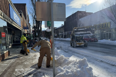
- LAURA JAMESON/THE EXPRESS Members of Lock Haven’s Public Works Department clear snow from sidewalks with shovels and other equipment after a large auger and dump truck cleared the large piles of snow in parking spaces along East Main Street downtown. Snow removal along city streets and in parking areas will continue throughout the week.
-

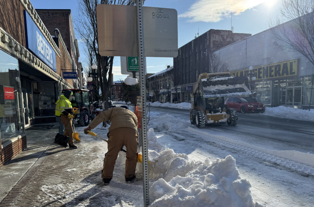
- LAURA JAMESON/THE EXPRESS A piece of equipment is pictured along East Main Street on Tuesday as crews worked to remove snow piled along the streets. Snow removal along city streets and in parking areas will continue throughout the week.
LAURA JAMESON/THE EXPRESS Members of Lock Haven’s Public Works Department clear snow from sidewalks with shovels and other equipment after a large auger and dump truck cleared the large piles of snow in parking spaces along East Main Street downtown. Snow removal along city streets and in parking areas will continue throughout the week.
LOCK HAVEN — Lock Haven City Public Works employees were busy early Tuesday morning as they began digging out on-street parking in downtown.
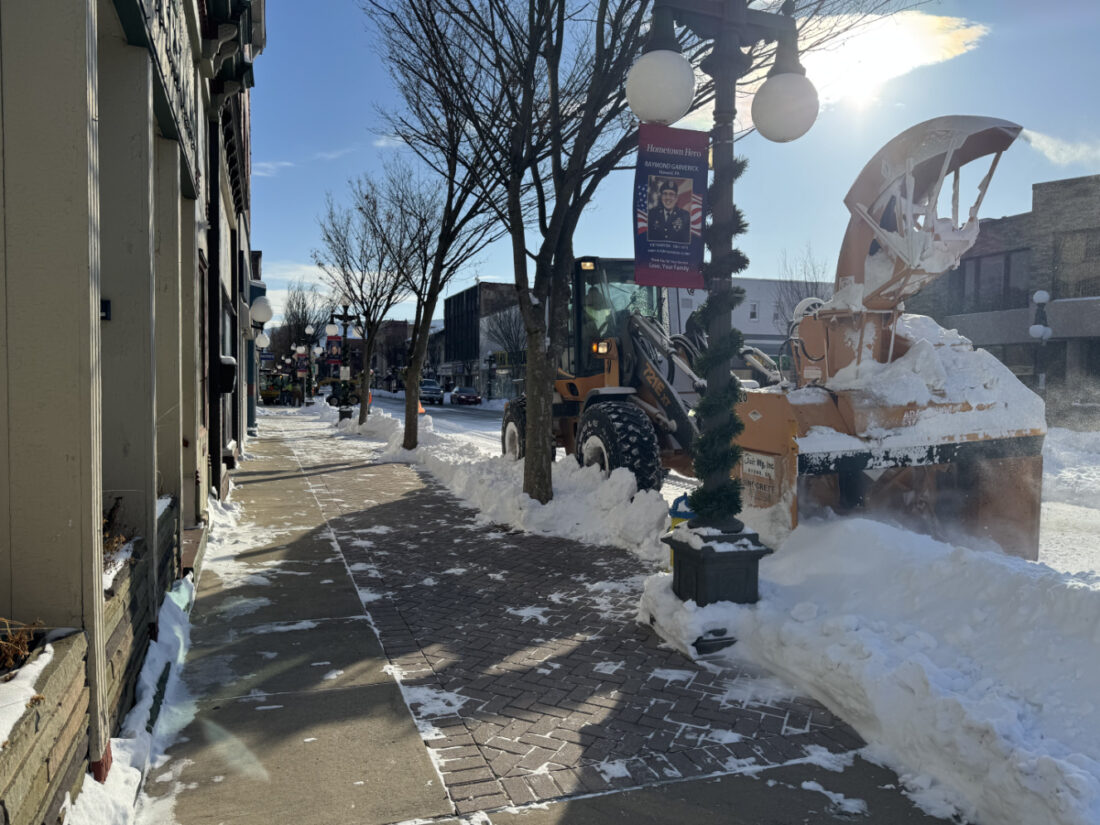
Crews were seen operating a variety of equipment and transporting the heaping piles of snow from the northern side of East Main Street.
According to Public Works Superintendent Jared Gist snow removal on Main Street and Bellefonte Avenue was handled on Tuesday, with Grove, Vesper and Water streets to Bald Eagle Street and Water Street from Jay to Nesbit today.
Gist said snow removal will continue on Thursday, with city crews working on Church Street from the five-way intersection to Jay Street, First Street and Bellefonte Avenue.
Employees will begin to remove snow from city-owned parking lots — located along Water, Main and Church streets — beginning that same day and into Friday.
LAURA JAMESON/THE EXPRESS A piece of equipment is pictured along East Main Street on Tuesday as crews worked to remove snow piled along the streets. Snow removal along city streets and in parking areas will continue throughout the week.
Interim-City Manager/Planner Abbey Roberts commended staff for their work during and after the storm that hit the area over the weekend.
“The City’s Department of Public Works has been working diligently to clear snow from roadways and parking lots since early Sunday morning. We appreciate their continued efforts through extended shifts and colder weather,” Roberts said.
She further asked that residents and business owners continue to offer patience as staff work to clear snow.
“While roadways are mostly clear, snow continues to impact on-street parking and parking lots in the city. Crews will address these areas as soon as possible and we appreciate patience from residents and business owners during this time. It is a lot of snow to move, but Public Works has a system for moving forward,” she said.
Roberts said any updates about snow removal will be shared on the city’s Facebook page as needed.
Subzero temperatures ahead;
Storm unlikely this weekend
If you’ve had enough of the wintry conditions for this year — well, we have bad news. Temperatures look to drop below zero overnight most of this week, with conditions ranging to potentially dangerous levels on Thursday and Friday nights, especially.
The better news is that no further snow accumulation is expected in the near future. A powerful storm is expected to roar up the east coast this weekend in classic Nor’Easter fashion, however, it is very likely to stay too far out to sea for us to see any substantial impacts here. As of the noon Tuesday model run, light snow from the system is barely pushing much beyond Philadelphia, let alone coming this way.
Of course, as always with winter storms, there is constantly room for change. But, as of Tuesday afternoon, it looks very unlikely for this storm to impact us.
What will definitely have an impact locally, however, is the bitter cold temperatures in place thanks to arctic air. The polar chill will keep high temperatures in the 15-20 degree range through at least this weekend.
Overnight cooling will bring those temperatures down to dangerous levels, with lows near or below zero every day this week.
Tonight will see a low of 1 degree Fahrenheit, with wind chills heading to -5.
That wind will calm down the rest of the week, but in its place will be raw cold: Thursday night will get down to -3, and Friday will see -6. If any light breeze does kick up, it will feel far colder.
By Saturday, we will see a little relief. The high will reach 19, and the overnight low will head north of 0 for the first time in a few days, to 6 degrees.
That trend looks to continue Sunday and Monday, with the high returning back to the 20s — imagine being happy to see that — and the overnight low returning to near 10.
Long range models are showing the chance for a potential front towards the middle of next week, which could potentially bring a few inches of snow our way. While it is much too far out to have certainty regarding track, timing or precipitation totals, this system does not look to be nearly as strong as the one which just passed through this past weekend, bringing around a foot of snow to most of the region.
— — — —
Arianna McKee contributed to this report.
Local news

World pauses to commemorate International Holocaust Remembrance Day
Killing of Alex Pretti has Pa.’s US senators testing party lines
Pennsylvania’s U.S. senators, Republican Dave McCormick and Democrat John Fetterman, have spoken out over the ...

Minneapolis shooting scrambles Second Amendment politics for Trump
Clearing the Way: City crews work to remove snow following storm; bitter temps expected all week

Centre County declares February CTE Month