
Wednesday night storm leaves flooding across Clinton County, with more possibly on the way
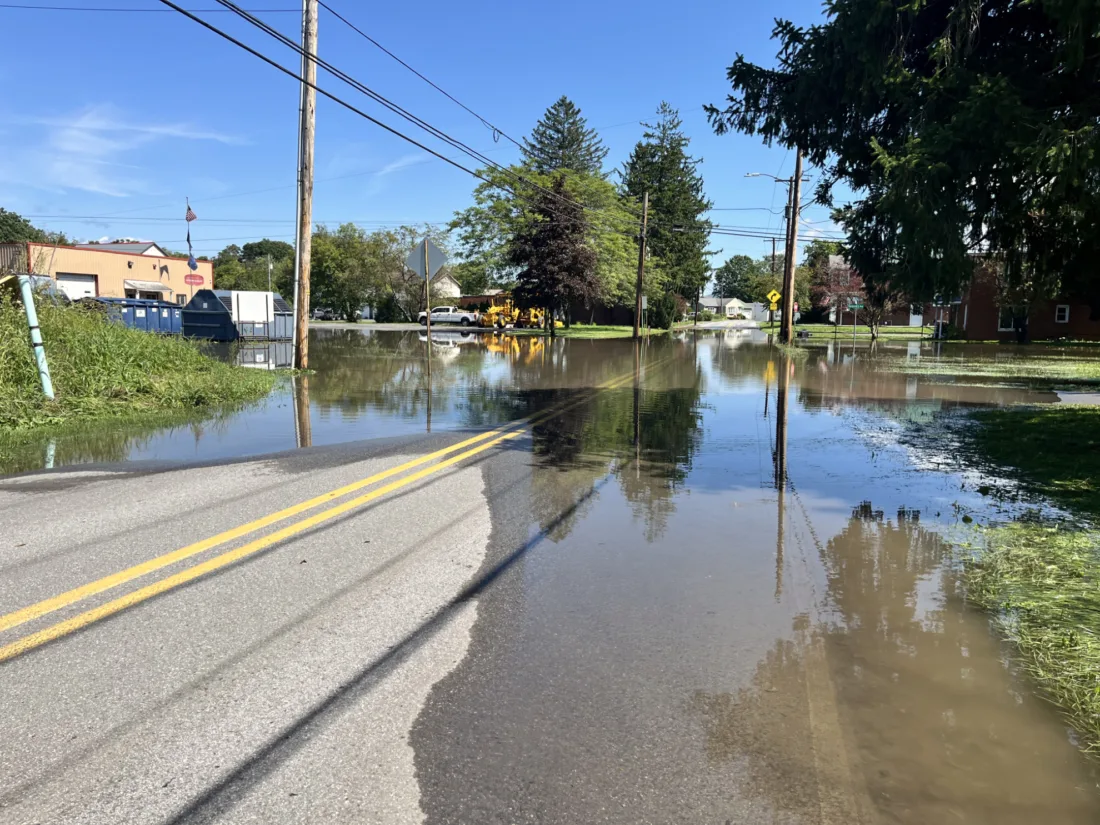
LAURA TARANTELLA/THE EXPRESS Floodwater covers the roadway in front of the Mill Hall Borough office Thursday morning following the overnight storm. Water stretched across the street and into surrounding grassy areas as residents dealt with the aftermath of the heavy rain.
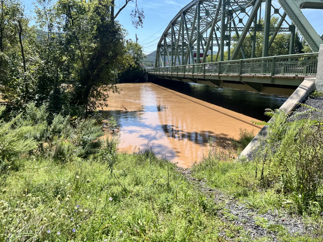
LAURA TARANTELLA/THE EXPRESS Floodwaters rise beneath a bridge in Flemington following heavy overnight rain that moved through Clinton County. The waterway, normally much narrower, had spread across the area beneath the bridge Thursday morning.
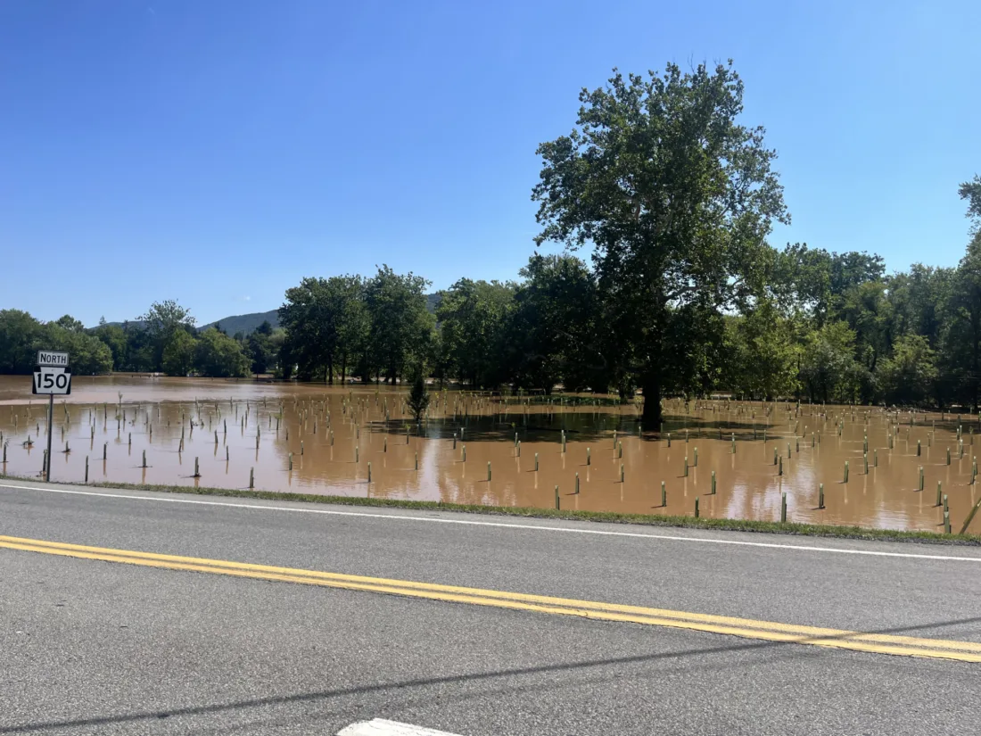
LAURA TARANTELLA/THE EXPRESS Floodwater covered the Bald Eagle Boat Ramp near Route 150 and Central Mountain High School following Wednesday night’s storm.
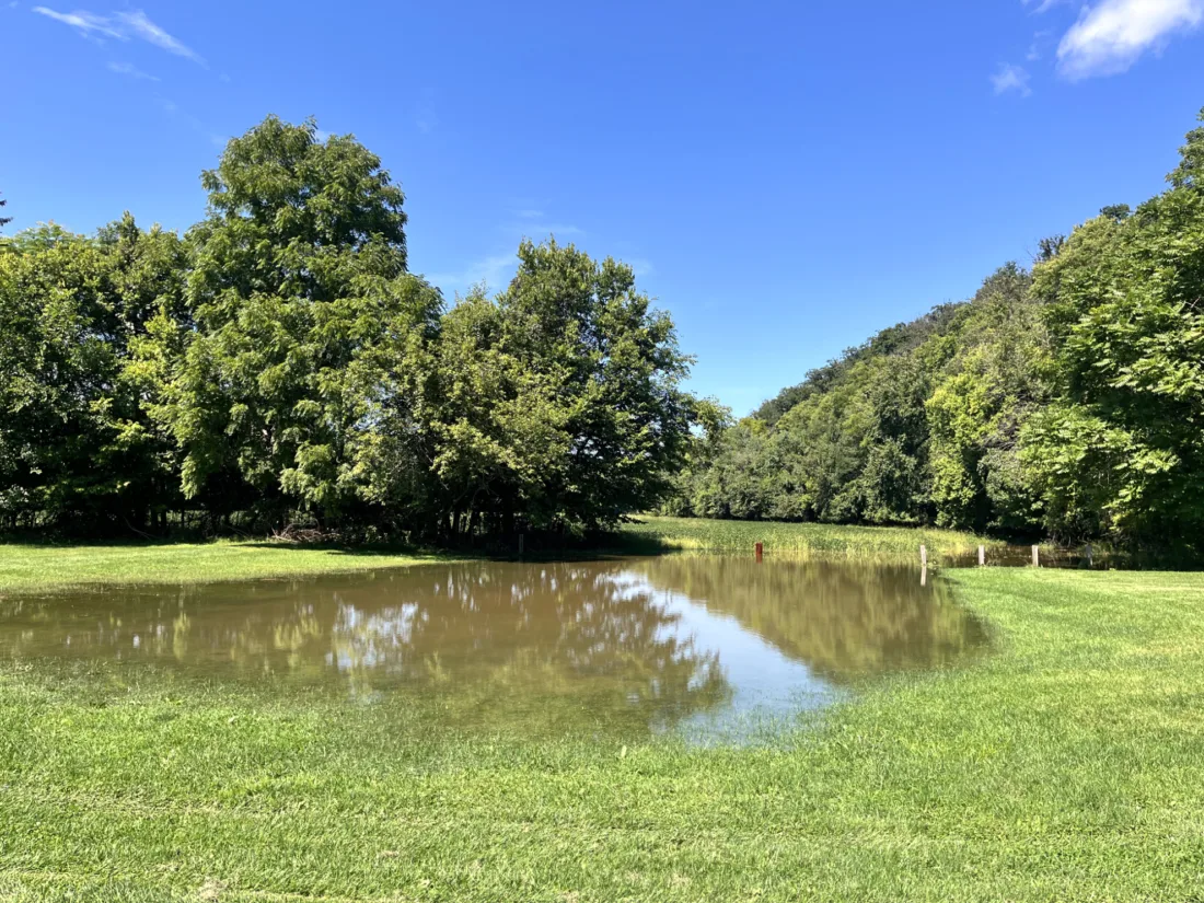
LAURA TARANTELLA/THE EXPRESS Floodwater covered parts of Woodward Township following Wednesday night’s storm.
LAURA TARANTELLA/THE EXPRESS Floodwater covers the roadway in front of the Mill Hall Borough office Thursday morning following the overnight storm. Water stretched across the street and into surrounding grassy areas as residents dealt with the aftermath of the heavy rain.
LAURA TARANTELLA/THE EXPRESS Floodwaters rise beneath a bridge in Flemington following heavy overnight rain that moved through Clinton County. The waterway, normally much narrower, had spread across the area beneath the bridge Thursday morning.
LAURA TARANTELLA/THE EXPRESS Floodwater covered the Bald Eagle Boat Ramp near Route 150 and Central Mountain High School following Wednesday night’s storm.
LAURA TARANTELLA/THE EXPRESS Floodwater covered parts of Woodward Township following Wednesday night’s storm.
Trending
Heavy overnight rainfall left areas of Clinton County dealing with flooded roads, waterways and low-lying areas Thursday morning, with some areas receiving more than 7 inches of rain in less than 24 hours.
The storm brought enough water to push waterways beyond their normal banks, with flooding visible in several locations around the county. Emergency responders worked through the night as water and debris covered roadways and residents were affected by flooding.
Much of that rainfall came during several intense rounds of storms over periods of only a few hours, producing rapid rises on creeks and streams and creating dangerous conditions on area roads.
The storms also produced severe weather across the region Wednesday night, including a tornado warning. Downed trees and other storm-related hazards were reported as emergency crews worked through the overnight hours and into Thursday.
Several roads were reported closed or affected by flooding in Centre and Clinton counties as of early Thursday morning.
In Centre County, Route 1002 (Marsh Creek Road) was closed between Howard Divide and Bald Eagle Valley roads.
In Clinton County, affected roads included Route 150 in both directions between Lusk Run and Mill Hall roads, Route 2019 (Laurel Run Road), Route 2020 (Lusk Run Road) near the township building, and Route 2022 (Sugar Run/Laurel Run Road).
Route 1016/2024 (Orviston/Beech Creek Road), which crosses Centre and Clinton counties, was also affected.
A section of the Bald Eagle Valley Trail was also reported closed Thursday afternoon, stretching from the Castanea Fire Station (Station 3) to mile 1.5.
The public must not use this section of the trail until further notice, due to severe storm damage. The rest of the trail remained open as of Thursday afternoon, however, caution was advised for anyone using the trail.
Despite some river and stream levels beginning to fall, officials throughout local townships continued to urge residents to remain cautious.
River and creek levels throughout the region, as of 3 p.m., Sept. 3, included:
Marsh Creek at Blanchard: 4.13 ft, down from a crest of 9.86 ft at 1:30 a.m. Thursday, Sept. 3 (previous record at this station was 7.8 ft)
Bald Eagle Creek: 11.60 ft., down from a crest of 15.12 ft at 5 a.m. Thursday, Sept 3 (record at this station is 16.0 ft);
Susquehanna at Lock Haven: 10.30 ft, with a crest of 12.20 ft forecast Friday, Sept. 4, 8 p.m. (action stage 17 ft);
Susquehanna at Renovo: 3.44 ft, with a crest of 8.80 ft forecast Friday, Sept. 4, 8 p.m. (action stage 12 ft);
Susquehanna at Jersey Shore: 9.75 ft, with a crest of 11.30 ft forecast Friday, Sept. 4, 8 p.m.
Saturated ground and already elevated streams mean that relatively small amounts of additional rainfall could quickly produce renewed flooding. Going from the numbers, the area between Lock Haven and Howard was especially hard-hit on Wednesday night.
As of 3 p.m. Thursday, Sept 3., rain gauges throughout the area registered as such:
Howard: 3.98 inches between Wednesday, Sept. 2 and Thursday, Sept 3, as of 3 p.m.;
Beech Creek: 7.45 inches between Sept. 2 and Sept 3., as of 3 p.m.;
Mill Hall: 5.20 inches between Sept 2 and Sept 3., as of 3 p.m.;
Lamar: 5.36 inches between Sept 2 and Sept 3; as of 3 p.m.;
Dunnstown: 4.33 inches between Sept 2 and Sept 3., as of 3 p.m.;
Avis: 3.71 inches between Sept 2 and Sept 3., as of 3 p.m.; and
Jersey Shore: 4.66 inches between Sept 2. And Sept 3., as of 3 p.m.
Lock Haven City Police were urging residents to avoid unnecessary travel if possible on Thursday. Those who must travel were asked to slow down, remain alert and avoid flooded roadways.
Even shallow moving water can be dangerous, and motorists were reminded not to drive around barricades or attempt to cross flooded roads.
Anyone experiencing an emergency should contact the Clinton County Communications Center at 570-748-2936 or call 911.
While flooding shown in photographs has been concentrated primarily in low-lying areas, conditions can change quickly as additional rain falls and waterways respond.
Residents are encouraged to monitor weather and emergency alerts, stay away from flooded streams and roadways, and never attempt to drive through water covering a roadway.
The full extent of damage to roads, waterways and local properties was not immediately available Thursday afternoon. Additional information on the severe weather conditions is expected as officials continue assessing the damage and responding to remaining flooding and storm-related problems.
As of Thursday afternoon, meteorologists were expecting additional rounds of thunderstorms -- potentially with more flooding rains -- Thursday evening and overnight into Friday; as well as yet another few rounds of the same on Friday.
However, Labor Day weekend is still on track to be gorgeous, beginning a dry stretch that will last through at least midweek. Temperatures will be in the mid-upper 70s, with relatively low humidity.