
Flooding storms bring misery to region; more rain on the way
Trending
LOCK HAVEN -- After an eventful night where the region experienced a wide range of severe weather conditions, storm gauges throughout Clinton County are showing significant amounts of rain -- and more is on the way today.
Going from the numbers, the area between Lock Haven and Howard was especially hard-hit.
As of 8 am. Thursday, Sept 3., rain gauges throughout the area register as such:
Howard: 3.93 inches between Wednesday, Sept. 2 and Thursday, Sept 3, as of 8 a.m.;
Beech Creek: 7.36 inches between Sept. 2 and Sept 3., as of 8 a.m.;
Mill Hall: 5.17 inches between Sept 2 and Sept 3., as of 8 a.m.;
Lamar: 5.32 inches between Sept 2 and Sept 3; as of 8 a.m.;
Dunnstown: 4.32 inches between Sept 2 and Sept 3., as of 8 a.m.;
Avis: 3.71 inches between Sept 2 and Sept 3., as of 8 a.m.; and
Jersey Shore: 4.66 inches between Sept 2. And Sept 3., as of 8 a.m.
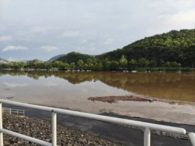
This amount of rain -- most of which occurred in the span of a few rounds of a few hours each -- has caused flood conditions throughout the area.
This morning, Lock Haven City Police posted a message on Crimewatch noting that area emergency responders "worked throughout the night responding to incidents and assisting residents affected by flooding, water and debris covered roadways, and downed trees."
The message acknowledges that there is still much to do, and urges patience, as "fire companies throughout Clinton County, along with state and local municipal crews, are working diligently to address as many issues as possible."
Police are asking that people try to avoid travel if possible, and, if necessary, to drive slowly and avoid flooded roads.
Emergency responders are hard at work -- please avoid giving them more to do to the best of your ability.
If you have an emergency, contact the Clinton County Communications Center at 570-748-2936 or call 911.
A flood watch continues for a huge swath of central Pennsylvania, including all of The Express's coverage area throughout Clinton, Centre and Lycoming counties.
The watch is currently in effect through midnight, however, it has been extended previously and more precipitation is forecast for Friday. With how little additional precipitation it takes to trigger strained creeks and streams to flood, it is likely this flood watch will be extended further.
According to the flood watch, "rainfall rates could exceed 3 inches per hour where several storms track east-southeast across the same locations. There should be a lull in the rain for several hours during the late morning and early afternoon hours today, before the thunderstorms greatly increase in number once again across Central Pennsylvania and the Susquehanna Valley."
Radar imaging is showing another big glob of rain heading straight for the area between Bellefonte and McElhattan. That round of rain should be ending by around 9:30 a.m. or so, before we enter that lull period the flood watch describes.
Severe thunderstorm conditions were also reported last night, including a tornado warning.
More information on these historic weather conditions will follow in tomorrow's edition of The Express.
In the mean time, be safe.