Donut Hole Trail follows Susquehanna River
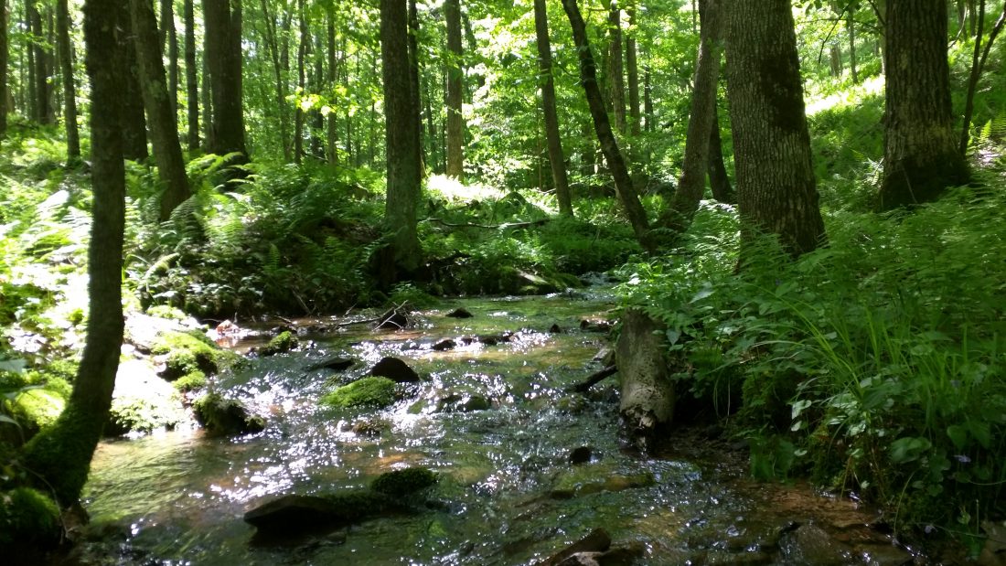
PHOTO PROVIDED A tributary of Cooks Run, seen from the Donut Hole Trail in western Clinton County in this photo taken by Ben Cramer.
(Editor’s Note: This is another in a continuing series of articles about Clinton County’s hiking trails.)
North-Central Pennsylvania abounds in hiking trails, from short jaunts at state parks to multi-county backpacking sojourns. The longest self-contained trail in the region is called the Donut Hole Trail (DHT), a remote path that is little known even to the region’s experienced backpackers. The DHT is 94 miles long, almost all of which is in Clinton County. Do not let the length of the trail scare you, because anyone can hike selected snippets of the trail at their leisure, if one knows where to find its most enjoyable points of interest.
The Donut Hole Trail follows a route that is roughly parallel to the West Branch Susquehanna River, traveling in a long semi-circle through Sproul State Forest. It starts at the village of Jericho, near the intersection of PA 120 and PA 872 in Cameron County, and heads east. The first five miles of the DHT are in Cameron County, but then most of the rest of its distance is in Clinton County — except for a couple of short dips across the line into Potter County to the north. The DHT passes through Kettle Creek, Hyner Run, and Hyner View State Parks, and ends in the small village of Farrandsville about seven miles up the river from Lock Haven.
For beginners and casual hikers, I highly recommend exploring snippets of the Donut Hole Trail at the state parks or the villages at either end. Parts of the DHT around the two “Hyner” parks are used in the annual Hyner Trail Challenge competitive hiking event. Serious backpackers can expect to complete the entire trail in 8 to 10 days.
The DHT has an intriguing history. It was first built in the 1970s and originally traveled between Kettle Creek and Hyner Run State Parks. It has been rerouted and extended several times, and settled into its current state in 2016 when a segment east of Hyner Run was abandoned and the trail was rerouted to the tremendous vista at Hyner View, which it had previously bypassed. To the southeast of that state park it now also passes through a forest research preserve operated by the Nature Conservancy of Pennsylvania.
The trail’s name is also historically interesting. The original construction project in the 1970s was part of a program that provided work for under-employed adults and at-risk youth, who were utilized by the staff of Sproul State Forest to construct a trail through that forest’s most scenic and remote areas. The workers, mostly from big cities, disliked this remote outpost and gave the area an unflattering anatomy-based nickname, the second syllable of which was “-hole” (use your imagination), and proposed that name for the trail they were building as well. Forest managers understandably rejected that idea, but converted the nasty name to “Donut Hole” to symbolize how this pristine area is surrounded by a circle of civilization.
The Donut Hole Trail’s remoteness resulted in little knowledge of its wonders even among Pennsylvania hikers. It did not have its own point-by-point guidebook until 2020, written by your present author. It took me 16 day hikes to measure, map, and record observations on the entire DHT and two of its side trails. During that project (except for a couple of friends who occasionally accompanied me), I did not see a single other hiker during almost the entire project, not even at the state parks, until finally meeting a couple on the second-to-last segment of my project. Overall I saw more bears than people.
That makes the DHT very rewarding for the serious backpacker who wants to get away from it all, but others should not be deterred. There is an unfortunate misconception amongst the public concerning long-distance hiking trails, as if they must complete the whole thing. Many people have heard of the 2,200-mile long Appalachian Trail from Georgia to Maine, but assume only diehards can tackle it, and may never consider the possibility of hiking a short and scenic segment of that trail near home. For the classic Clinton County hiking experience, in which you can enjoy the area’s surprisingly remote and pristine forests and vistas, consider a hike of any length on the Donut Hole Trail.
— — — —
Ben Cramer is a resident of State College who has hiked more than 5,000 miles in Pennsylvania and has written six books about the state’s long-distance backpacking trails. He teaches at Penn State University. Guide to the Donut Hole Trail by Ben Cramer (2020) is available at select outdoor retailers throughout Pennsylvania, and can also be ordered at www.PAHikes.com.
Local news

It takes a village: Centre County recognizes county child welfare workers
Council takes steps for Tiger Den plans; community encouraged to take part for playground, dog park
LOCK HAVEN — Lock Haven City Council and staff are ready to work with members of the community to find ways to ...
Local car cruise in Sugar Valley keeps memories alive
LOGANTON — A little over a week ago, under grey and cloudy skies, a convoy of dozens of vehicles formed at the ...
Best of Clinton County returns to DLH June 13
LOCK HAVEN — Downtown Lock Haven, Inc. has announced its annual Best of Clinton County Festival will be ...

Bucktail announces Flaming Foliage representative at annual awards
Cheers to 250 Year: Flemington Boro plans major celebration for America’s milestone
FLEMINGTON — Hot dogs, apple pie and baseball will take center stage in Flemington on Saturday, June 6, as ...